Thursday 20 March 2025
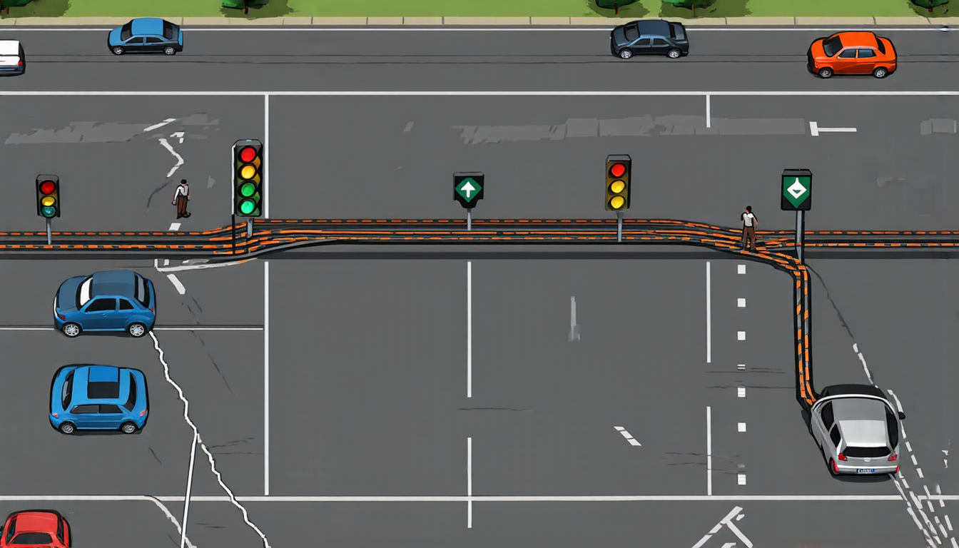
Maps have long been a crucial tool for navigation and exploration, but traditional maps often lack the level of detail needed for autonomous vehicles to safely navigate complex road networks. Standard Definition (SD) maps are widely used, but they can only provide basic information about roads, without considering factors like lane markings, traffic signals, or pedestrian paths.
Recently, researchers have been working on creating more detailed and accurate maps using Large Language Models (LLMs). These models are trained on vast amounts of text data, allowing them to learn patterns and relationships between words. By leveraging this ability, the LLMs can extract information from official documents like highway design manuals to enhance SD maps with lane-level details.
The new approach, dubbed SD++, uses a combination of natural language processing (NLP) and machine learning techniques to generate detailed road maps. The process begins by filtering out non-road-related data from OpenStreetMap (OSM), a collaborative project that provides free geographic data. Next, the LLMs are trained on official documents, such as highway design manuals, to learn about lane markings, traffic signals, and other important features.
Once the models have learned these patterns, they can be applied to SD maps to generate more detailed and accurate representations of road networks. The resulting maps include information about lane boundaries, traffic signals, pedestrian paths, and even bike lanes. This level of detail is crucial for autonomous vehicles, which need to understand complex road environments to ensure safe navigation.
To test the effectiveness of this new approach, researchers applied SD++ to OSM data from California and Japan, two regions with distinct road network characteristics. The results showed that SD++ was able to generate highly accurate maps, even in areas where traditional mapping methods struggled. The models were able to capture subtle details like lane markings, traffic signals, and pedestrian paths, providing a more comprehensive understanding of the road environment.
The implications of this research are significant, as it has the potential to improve the safety and efficiency of autonomous vehicles. By providing more detailed and accurate maps, SD++ can help reduce the risk of accidents caused by misinterpretation or poor navigation. Additionally, the approach can be applied to other domains where mapping is critical, such as urban planning, environmental monitoring, and emergency response.
In the future, researchers plan to further refine the SD++ approach, exploring ways to integrate sensor data from autonomous vehicles with the LLM-generated maps.
Cite this article: “Enhancing Autonomous Navigation through Advanced Mapping Techniques”, The Science Archive, 2025.
Autonomous Vehicles, Mapping, Navigation, Large Language Models, Natural Language Processing, Machine Learning, Road Networks, Lane Markings, Traffic Signals, Pedestrian Paths


